


Hello skiers and snowboarders,
The New Year is bringing a bounty of new snowfall. This Monday we are expecting light snowfall however snow levels briefly go up in the afternoon to 4000 to 6000' but lower in the evening. Then Tuesday low snow levels and new snow of 20 inches during the day.
However, it will be windy at the ridgetops with wind gusts of 40 to 50 mph. Also, the air mass is unstable so chances of thundershowers on Tuesday. Given these conditions, DOT might have challenges keeping roads open at times.
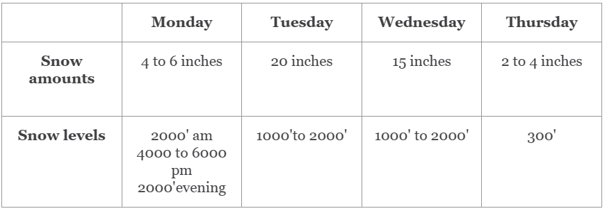
On Wednesday we will have lower wind speeds of 15 to 20 mph at ridgetops and will have additional snow of 15 inches. For Thursday a weak ridge of high pressure is just off our coast, so with these conditions, we can expect lighter snowfall. The best chance of snow will be south of Snoqualmie Pass. Thursday certainly looks like a favorable day to ski, although Wednesday will bring lots of new snowfall to enjoy.
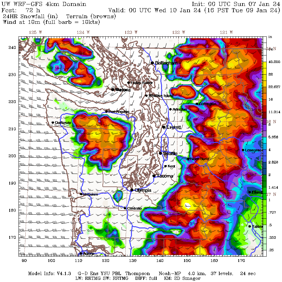
24-hour snowfall for Tuesday, Jan 9
Over 20" in some locations. Source
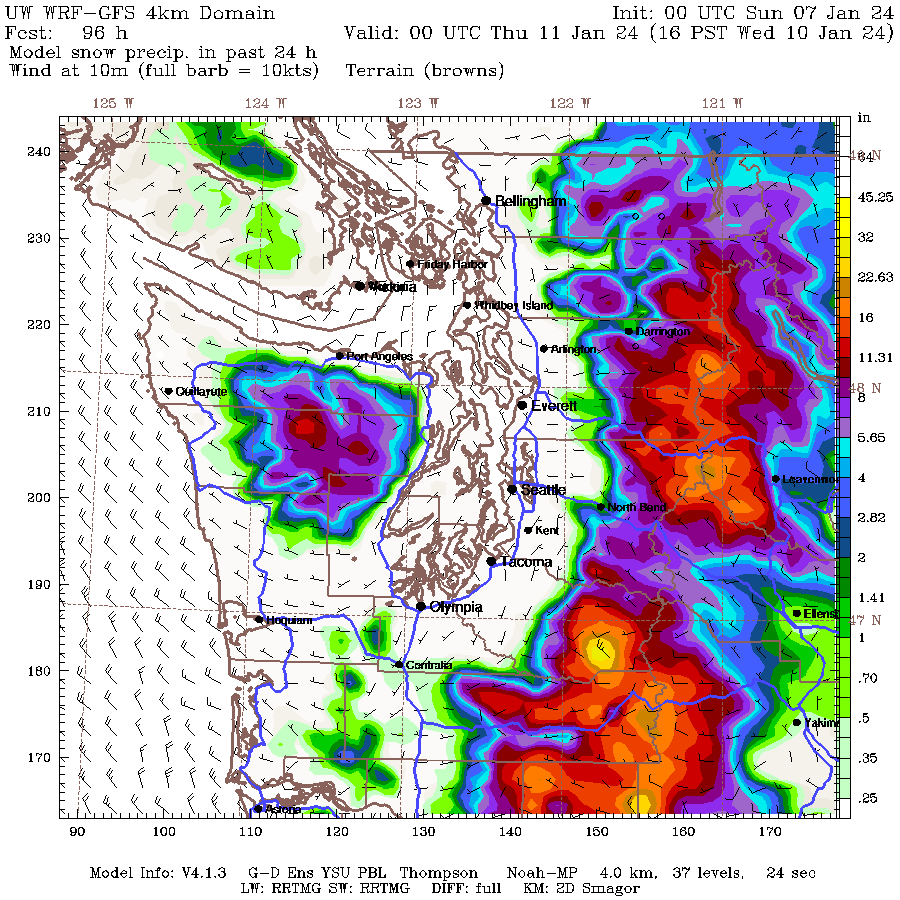
24-hour snowfall for Wednesday, Jan 10
Over 15" in some locations. Source
|
|


